
Acropolis Map ✨
Use this interactive Acropolis map to explore every monument, entrance, and walking route on the sacred rock, which served as the citadel - a historic fortress and central point of ancient Athens - before you arrive.
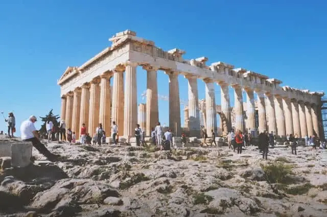
The perfect Acropolis Map
The Acropolis of Athens covers a compact but densely packed hilltop on Acropolis Hill, and having a reliable Acropolis map before you visit helps you navigate the hilltop efficiently instead of wasting time on a rushed scramble. The archaeological site sits on a limestone rock that rises about 156 metres above sea level, and its footprint stretches about 300 metres from east to west.
Within that space, more than a dozen monuments span roughly six centuries of construction - from the 5th-century BCE Parthenon down to the Roman-era Odeon of Herodes Atticus (161 CE) on the southern slope. The Athens Acropolis holds immense historical significance as a symbol of Western civilization and democracy, representing the enduring legacy of ancient Greece and its pivotal role in Greek history.
The Acropolis also served as a religious center for ancient Athens, with the Parthenon dedicated to Athena, the city’s patron goddess, symbolizing the political and cultural power of Athens during its Golden Age and its importance in the city’s history. For visitors, tourists, and anyone interested in ancient architecture, cultural heritage, or Greek history, knowing the layout before arrival makes it easier to pace the climb, understand what you are seeing, and move between the site’s main monuments without missing key stops.
Below you will find an interactive Acropolis map that lets you navigate the ancient citadel by plotting every major structure, route, and key visitor point on the hill. Tap or click any numbered marker to read a short overview of that monument, its construction date, and what makes it worth pausing for. The map also marks both entrances, ticket booths, restroom facilities, and the elevator on the northwest slope. Along with the layout of the main monuments, it helps you follow walking routes, locate practical access points, and get quick answers to common visit-planning questions, while the fortified walls and other buildings on the plateau show how the site developed across different eras.
Interactive Map of the Acropolis of Athens
How to Read This Acropolis Map
The map above is oriented with north at the top, as on most site plans of the Acropolis. The western edge of the plateau - the left side of the map - is where the Main Entrance and the monumental gateway, the Propylaea, are located at the western end of the Acropolis, a practical location for orienting yourself on arrival. The southeastern corner - the lower right - is where you will find the Theatre of Dionysus and the second gate, used as a side entrance.
Walking from west to east across the hilltop, you pass the main monuments in this order: the Propylaea threshold gives way to the Sanctuary of Artemis Brauronia, then the vast open terrace dominated by the Parthenon, and finally the Erechtheion and its Porch of the Caryatids on the northern rim.
The south slope, visible below the perimeter wall, holds the two great theatres - the Odeon of Herodes Atticus and the Theatre of Dionysus - connected by the long Stoa of Eumenes colonnade. The blending of Doric and Ionic columns throughout the site reflects the significance of ancient Greek architecture in the design and organization of the Acropolis.
Book the best Acropolis ticket
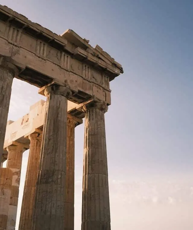
Acropolis & Parthenon Tickets with Optional Audio Guide
Skip the ticket lines and step into ancient history at your own pace. Explore the iconic Parthenon, Temple of Athena Nike, and Theatre of Dionysus with a multilingual audio guide that reveals the myths, legends, and stories behind Athens' most treasured monuments.
Includes:
- Timed entry to the Acropolis
- Audio guide in English, French, German, Spanish & Italian
- Offline audio guide and map on your phone
Best price starting at:
39 €
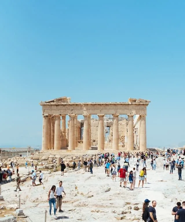
Acropolis & Parthenon Guided Tours with Entry Tickets
Explore the Acropolis with an expert guide who brings ancient history to life. Small groups, headsets for clear audio, and plenty of time for questions and photos. Enhance your visit with optional add-ons like the Acropolis Museum, Ancient Agora, or a walk through Plaka.
Includes:
- Guided tour of the Acropolis & Parthenon
- Skip-the-line entry
- Guide in English, Spanish, French, German, or Italian
Best price starting at:
34 €
Combo: Acropolis & Parthenon + Acropolis Museum Tickets
One plan, two iconic sites. Walk through the Acropolis hilltop monuments with reserved timed entry, then explore the Acropolis Museum, all connected by multilingual audio guides on your phone with offline maps, narration, and interactive content.
Includes:
- Time-slotted e-ticket to the Acropolis & Parthenon
- Entry ticket to the Acropolis Museum
- Audio guide in English, German, French, Spanish, Italian & Greek
Best price starting at:
75 €
Key Monuments on the Acropolis Map: Including the Temple of Athena Nike
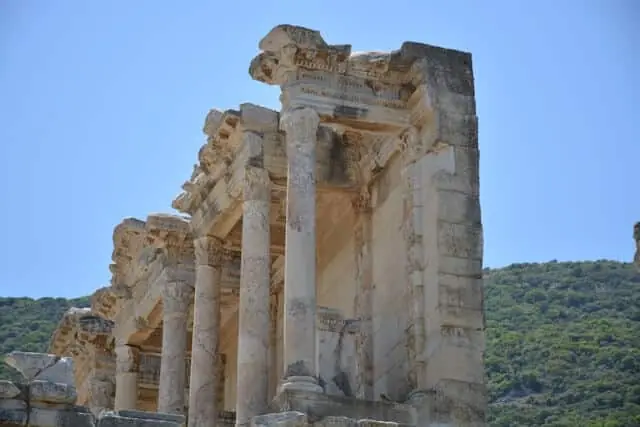 The Propylaea
 stands at the western edge of the plateau as the formal entrance to the sacred precinct. Architect Mnesikles built it between 437 and 432 BCE. The gateway consists of a central hall flanked by two wings - the northern wing once served as the Pinakotheke, a picture gallery described by the ancient traveller Pausanias.
Six Doric columns frame the western facade, while slender Ionic columns line the interior passage - the first classical building to blend both orders so prominently. Construction was never fully completed due to the Peloponnesian War, yet it remains one of the most impressive gateways in the ancient world.
The Acropolis is also home to the foundations of the Old Temple of Athena (Archaios Naos), which predates the Parthenon and is significant for understanding the site's religious and architectural history. Its remains highlight how important this spot was for worship in ancient Athens.
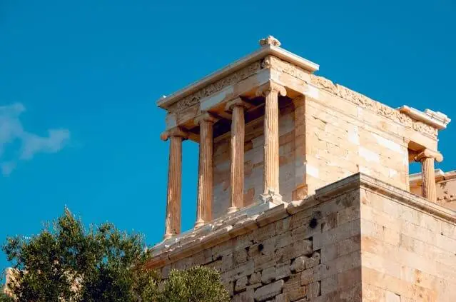 Temple of Athena Nike
Perched on the bastion at the southwest corner, this small Ionic temple is one of the most historically resonant structures on the Acropolis. Designed by the architect Kallikrates, it was built from about 427 BCE and completed by about 420 BCE, dedicated to Athena as goddess of victory.
The frieze originally depicted battle scenes from the Greek victories over the Persians, including the decisive encounter at Plataea in 479 BCE. A marble balustrade once surrounded the bastion, carved with winged figures of Nike. The statue of Athena inside was notably wingless - symbolising that victory would never leave the city. Restoration of the Temple of Athena Nike was completed in 2010, showcasing ongoing efforts to preserve the Acropolis monuments.
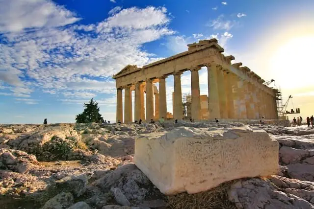 The Parthenon
Dominating the centre of the Acropolis, the Parthenon is the largest and most famous structure on the hill. Built between 447 and 438 BCE during Athens' Golden Age (460-430 BC) from white Pentelic marble, it was dedicated to Athena Parthenos. The Parthenon is the most renowned temple on the Acropolis, showcasing Doric columns and intricate friezes that exemplify ancient Greek architectural precision. Architects Iktinos and Kallikrates designed it with eight columns on each short side and seventeen along each flank. The sculptor Phidias oversaw the decorative programme as part of Pericles' building program on the Acropolis and created the monumental chryselephantine statue of Athena, twelve metres tall, inside the inner chamber. Nearby stood Athena Promachos, a colossal statue that reached 9 meters in height.
What makes the Parthenon remarkable beyond its scale is its system of optical refinements. The columns taper slightly and lean inward. The stylobate curves gently upward at the centre. These adjustments counteract optical illusions, producing an impression of perfect proportion that has captivated architects for twenty-five centuries.
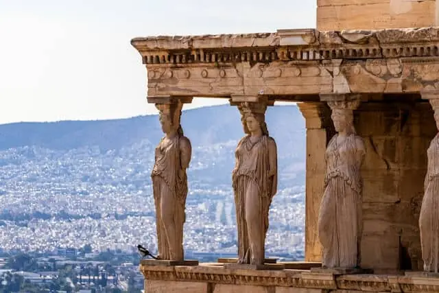 The Erechtheion
On the northern side of the Acropolis, the Erechtheion occupies what ancient Athenians considered the most sacred ground on the hill - the spot where Athena and Poseidon competed for patronage of the city. Construction ran from roughly 421 to 406 BCE, interrupted by the Peloponnesian War. Its irregular plan reflects the need to accommodate multiple cult sites, including shrines to Athena Polias, Poseidon-Erechtheus, Hephaestus, and the hero Boutes.
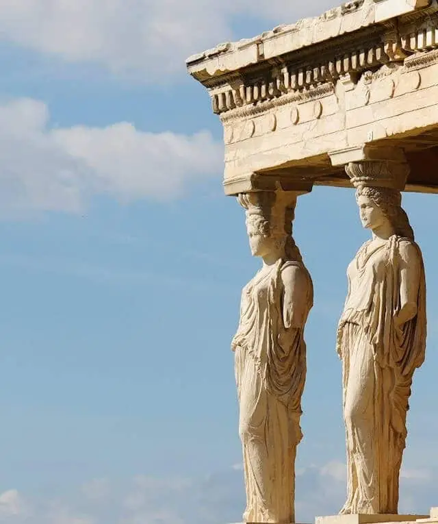
The south porch is its most photographed feature: six sculpted female figures - the Caryatids - serve as structural columns supporting the roof. The figures on site today are faithful replicas. Five of the originals are in the Acropolis Museum; the sixth was taken by Lord Elgin and remains in London.
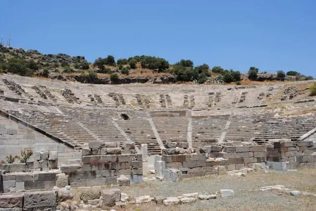 Theatre of Dionysus
At the southeastern foot of the hill, the Theatre of Dionysus is where Western drama was born. In the 5th century BCE, playwrights Aeschylus, Sophocles, Euripides, and Aristophanes premiered tragedies and comedies here during annual festivals honouring Dionysus.
The original wooden benches were replaced with stone seating in the 4th century BCE, expanding capacity to approximately 17,000 spectators. The semicircular layout became a template for theatres across the Roman Empire. The front-row marble thrones, reserved for priests and dignitaries, are still visible and remarkably well preserved. The Theatre of Dionysus is known as the birthplace of European theater.
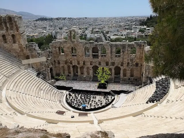 Odeon of Herodes Atticus
Visible on the southwest slope of the Acropolis, the Odeon was built in 161 CE by the wealthy Athenian patron Herodes Atticus as a memorial to his wife Regilla. Unlike the older Theatre of Dionysus, it was designed as a roofed concert hall with a capacity of roughly 5,000 spectators.
The original cedar-wood roof has long since vanished, but the steep stone seating and the three-storey stage wall survive in impressive condition. Today the Odeon hosts the Athens and Epidaurus Festival each summer, with performances ranging from classical music and opera to contemporary theatre under the Athenian night sky.
Suggested Walking Route Using the Acropolis Map: Entering via the Main Entrance
A logical circuit across Acropolis Hill takes roughly 1.5 to 2 hours at a relaxed pace, depending on how long you linger at each monument. If you enter through the Main Entrance on the western side, the natural route unfolds as follows: pass through the Propylaea, glance right to the Temple of Athena Nike on its bastion, continue east past the Sanctuary of Artemis Brauronia and the Chalkotheke, where you’ll also find ancient altars and shrines dedicated to gods such as Athena and Zeus Polieus, who were worshipped here. Then approach the Parthenon from its western facade. Circle the Parthenon along the north side to reach the Erechtheion and its Caryatid porch, pause at the Pandroseion to see the replanted olive tree, then return along the south side of the Parthenon for panoramic views over the Theatre of Dionysus and the city beyond.
If you enter through the Southeast Entrance near the Theatre of Dionysus, start with the south slope: climb through the archaeological zone, where sanctuaries and altars reflect the worship practices of ancient Athens, and pass the Asklepieion healing sanctuary and the Stoa of Eumenes. The path then leads west and up to the Propylaea, because the summit can only be entered there. From the Propylaea, follow the same circuit as above: Temple of Athena Nike, Parthenon, Erechtheion and back along the south side.
Whichever direction you choose, keep this map of the Acropolis on your phone so you can identify structures as you encounter them. Audio guides - available in multiple languages, also on our ticket page - follow numbered stops, so you can match each commentary to the monument in front of you. If you extend the walk, the Acropolis Museum is 280 meters from the Parthenon.
Practical Tips for Navigating the Acropolis Site
The terrain on the Acropolis plateau is uneven marble and exposed limestone. Surfaces become slippery when dry and dusty, and dangerously slick after rain. Sturdy closed-toe shoes with good grip are essential - sandals and smooth-soled trainers are a common regret. There is very little shade on the hilltop itself. In summer, temperatures on the open rock can exceed 40 °C. Carry at least one litre of water per person and wear a hat. Restrooms are available near the entrances, including accessible facilities for wheelchair users.
Photography with smartphones and personal cameras is permitted throughout the site, but tripods, drones and selfie sticks are prohibited, and flash photography is not allowed in some areas. Large bags and food are not allowed either; water is fine. Professional filming requires a permit from the Hellenic Ministry of Culture. For up-to-date admission prices and booking details, visit our official Acropolis tickets website guide. The elevator for visitors with disabilities is located on the northwest slope, accessible from the Main Entrance. It operates during standard site hours but may be suspended in extreme weather or high winds.
Frequently asked questions
01 Why do I need an Acropolis map?
The Acropolis archaeological site contains more than a dozen monuments spread across an uneven hilltop, and signage on site is limited to small plaques and a few direction signs. An Acropolis map lets you identify each structure, plan a logical walking route, and locate practical facilities like entrances, restrooms, and the wheelchair elevator - all of which saves time and avoids unnecessary backtracking in the heat.
02 Where are the two entrances on the Acropolis map?
The Main Entrance is on the western side of the hill, at the end of Theorias Street near the Propylaea. The Southeast Entrance is on Dionysiou Areopagitou Street beside the Theatre of Dionysus, and it functions as a side entrance that can help you avoid the busier western approach. Both are marked on the interactive map above and follow the same seasonal opening hours.
03 How long does it take to walk the full Acropolis site?
A complete circuit of the hilltop takes roughly 1.5 to 2 hours at a comfortable pace, including brief stops at each monument. If you add the south-slope theatres, plan for about 2.5 to 3 hours. Together with the Acropolis Museum at the foot of the hill, about 280 meters from the Parthenon, the visit takes about 4 hours, or half a day.
04 Is the Acropolis accessible for wheelchair users?
Yes. An elevator on the northwest slope provides step-free access from the Main Entrance to the hilltop. Once at the top, two relatively level routes allow wheelchair users to see the Parthenon and the Erechtheion. The elevator operates during standard site hours and may close in extreme weather.
05 Can I download the Acropolis map for offline use?
Yes. You can screenshot the interactive map above or save this page before your visit. The audio guide included with some tickets, such as our Acropolis ticket with audio guide, also offers offline access and a map with numbered stops.
06 What is the best walking route through the Acropolis?
If you enter from the Main Entrance, walk east through the Propylaea, past the Temple of Athena Nike, circle the Parthenon along the north side to reach the Erechtheion, then return along the south for panoramic views. If you enter from the southeast, you first climb the south slope and also reach the summit through the Propylaea, then follow the same circuit.
07 Are there restrooms inside the Acropolis?
Yes, but they are located near the entrances rather than on the hilltop, including accessible restrooms for visitors with mobility needs. It is best to use them before you start the climb.
08 What monuments should I not miss on the Acropolis map?
The five essential stops are the Propylaea gateway, the Temple of Athena Nike, the Parthenon, the Erechtheion with its Caryatid porch, and the Theatre of Dionysus on the south slope. If time permits, the Odeon of Herodes Atticus and the Sanctuary of Artemis Brauronia are also well worth visiting.
09 Is the Acropolis map the same as the Acropolis Museum map?
No. The Acropolis Museum is a separate modern building at the foot of the hill and one of the closest attractions to the site, with its own floor plan. The Acropolis map covers only the open-air archaeological site on the hilltop and its slopes, while the museum map applies only to the indoor galleries. A combined visit to both is highly recommended.
10 Can I use the interactive Acropolis map on my phone during my visit?
Yes. The interactive map above works on any mobile browser. Save this page before you visit so you can reference it on-site, even if your data connection is unreliable on the hilltop.